Tag: Spatial Data Analytics

ONLINE – Expert Group Meeting – Spatial Data

The next Expert Group meeting of Spatial Data will be in December.
The meeting will by physical in the Gleisarena Zürich! The meeting has been changed to being online! A Teams-link will be sent to all registered participants.

Main topic of the discussion will be GIS and health.

With the earth as reference object (“geospatial”):
On Her Majesty’s Secret Service – Die Bedeutung von Raum und Zeit aus pharmakologischer Sicht
Talk by PD Dr. med Stefan Weiler, EMBA
Experte European Medicines Agency
Senior Researcher ETH Zürich Pharmakoepidemiologie

With the human body as reference object:
The World Is Not Enough – Die Bedeutung von Raum und Zeit in der Klinik
Talk by Dr. Joachim Steinwendner, MSc.
Forschungsfeldleiter “GeoHealth”, FFHS
Dozent ETH, CAS RIS/GIS

  • Open discussion
  • Chat in wonder.me

Please register using the form below.
Webinar: Geodatenschätze und die vielfältige Nutzung

⇒ Zu obigen und weiteren Webinaren werden auf www.geosummit.ch schrittweise zusätzliche Angaben zu Inhalten und Referent*Innen aufgeschaltet. Es werden auch noch weitere Webinare dazukommen.

Eine Registrierung ist erforderlich, damit der Zutritt ins Webinar gewährt wird.
Registrierung

Dank der Unterstützung von Innosuisse und den Gold-, Silber- und Bronzepartnern sowie Kongresspartner können die Webinare im 2021 kostenlos angeboten werden. Möchten Sie die Leistungen des Vereins GEOSummit anerkennen, so können Sie einen Ihnen beliebigen Betrag überweisen. Die Bankangaben finden Sie auf der Buchungsbestätigung. Die freiwilligen Beiträge werden für die Organisation des nächsten GEOSummit – hoffentlich wieder «analog» durchgeführt – eingesetzt.

Unterstützer: Innosuisse – Schweizer Agentur für Innovationsförderung

Die Goldpartner sind: Hexagon Schweiz AG, ESRI SCHWEIZ AG, GEOCOM by VERTIGIS, EXOLABS
Die Silberpartner sind: DeltaOffice, Schutz vor Naturgefahren, BENNETBILL, CENTRE PATRONAL, INSER, viadiversa
Die Bronzepartner sind: iNovitas und digitalswitzerland
Die Kongresspartner sind: SOGI, GEOSUISSE, IGS, KGK, GKG, FGS, SGK, SGPF und FHNW.

Einen herzlichen Dank an alle Partner.
Partner GEOSummit

Registrieren Sie sich für die Webinare! Ohne Registrierung gibt es keinen Zutritt zu den Webinaren. Das Organisationskomitee freut sich, Sie im digitalen Raum begrüssen zu dürfen.

Freundliche Grüsse und beste Gesundheit wünscht
Verein GEOSummit

Pol Budmiger, Präsident
Thomas Meyer, Geschäftsführer.

Spatial Data Analytics at the
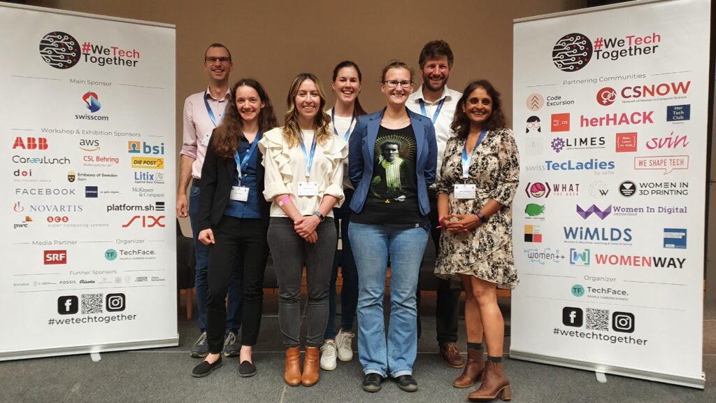
#wetechtogether conference, 02.10.2021

By Nicolas Lenz, Litix Applied Data Science

Spatial Data was a workshop topic at the #wetechtogether conference which took place on October 2. The data innovation alliance, its member Litix and WiMLDS Zurich sponsored and organized two workshops entitled “Jump into Geodata”. The participants learned how to access Swiss geoservices with Python and how to use them for the presentation and analysis of geodata. We would like to thank the participants for their attendance and the lively discussions in the workshops. We hope that this will lead to new innovative geospatial projects in the future!

Innovative ideas around geodata are indeed welcome, since Spatial Data Analytics is one of four focus topics in the Databooster initiative. Project ideas related to geospatial data have increased chances of receiving Databooster support!

Being part of the #wetechtogether conference was a great experience for data innovation alliance and Litix. We support the main goal of the conference to empower people to bring more diversity into tech. We are already looking forward to the 2022 edition!

SDS Workshop – The Untapped Potential of Open Geodata

The world is becoming increasingly data-driven. But if there are restrictions on the access and use of data, data-driven business and governance is strongly limited. In this content, open data has its own unique place. It can help with global challenges such as climate change adaptation or famine, it can give companies a competitive advantage, and it can streamline processes and systems that society and governments have built. Moreover, open data can empower citizens and thus strengthen democracy. In short, it can help to change the way we understand and interact with the world. There are many types of open data, but due to the geographic element geodata deserves special attention, both in terms of quantity and quality. In this workshop the importance of open geodata is discussed and success stories of projects based on open geodata are presented. Platforms and initiatives related to open geodata as well as funding opportunities will be presented and discussed.

Lessons to be learned

  • Get to know data portals for open geodata
  • Overview of the application potential of open geodata
  • Terms of use for open geodata (Open Government Data and others).
  • Insights into the Open Government Data Strategy.
  • Insights on how to crowdsource open data.

Target Audience (beginner level to intermediate level)
Data Managers, Data Engineers, Data Analysts, Statisticians. Academics and everyone who is interested in the topic of data science.

To participate in the workshop please register using the SDS2021 website.

  • 1
  • 2